

Follow this alert in real time
Download ClickAlert to get notifications


Information bulletin
Orange weather warning for thunderstorms on Monday, August 24, 2026
Automatically translated from French ·

Published on Thursday, October 1, 2026 at 3:25 PM
# Orange weather warning for thunderstorms on Monday 24 August 2026 Updated on 24/08/2026 **The department of Bouches-du-Rhône is under an orange weather warning for "thunderstorms" and a yellow weather warning for "rain-flooding" and "wave-submersion" on Monday 24 August 2026 from 19:00** Météo France has placed the department of Bouches-du-Rhône under an orange weather warning for "thunderstorms" from 19:00 on Monday 24 August 2026. The department will also be under a yellow weather warning
Orange weather warning for thunderstorms on Monday, August 24, 2026
Updated on 08/24/2026
The department of Bouches-du-Rhône is under an ORANGE weather warning for "thunderstorms" and a YELLOW weather warning for "rain-flooding" and "wave-submersion" on Monday, August 24, 2026, starting at 7:00 p.m.
Météo France has placed the department of Bouches-du-Rhône under an orange weather warning for "thunderstorms" starting at 7:00 p.m. on Monday, August 24, 2026.
The department will also be under a yellow weather warning for "rain-flooding" and "wave-submersion" along the coastal areas of the department.
The Météo France bulletin
An intense and brief thunderstorm episode is developing this Monday evening, quickly moving from west to east across the region before dissipating toward Corsica. Violent thunderstorm cells may affect the department, particularly in the plains and near the coast. Under these cells, phenomena such as hail (quite large and widespread), strong wind gusts of around 90 to 110 km/h, and up to 130 km/h near the coast, as well as heavy rainfall intensities of approximately 50–70 mm/h, are possible. Additionally, the risk of tornado-like phenomena is non-negligible near the coasts.
The Prefect of Bouches-du-Rhône reminds everyone of the safety guidelines to ensure the safety of all:
* Limit your movements. If you absolutely must drive, never enter a flooded road, even partially or exposed to waves.
* Avoid walking or driving near the sea and stay away from exposed structures (pier, seawalls, etc.).
* Be especially vigilant if you are engaging in outdoor activities near a river or the coastline. Avoid going to sea or engaging in nautical activities.
* Do not go down into basements, cellars, or underground parking areas.
* Stay away from trees, rivers, and low-lying areas that could quickly flood.
* Shelter people, animals, and belongings exposed to the risk before the storm event arrives.
* Secure or fasten objects that could be blown away by the wind, and protect property that could be damaged by heavy rain.
* Campers and guests staying in outdoor accommodations are asked to follow instructions from site managers and to move to safety quickly if weather conditions deteriorate.
* Check your boat's mooring; do not remain on board.
Stay informed about the evolving weather situation:
- by visiting: http://vigilance.meteofrance.com and following @prefet13 on social media
- by listening to local media (Ici Provence)
Guides for Bouches-du-Rhône

Drowning prevention: CoulePasTonÉté campaign
The 13th department prefecture launches the #CoulePasTonÉté campaign to raise awareness about the dangers of swimming outside secured zones. The posters warn against currents, rocks, boats, and metal pilings in waterways.

Forest fire prevention in Bouches-du-Rhône
Due to high human activity, 9 out of 10 fires are of human origin. On August 15, vigilance is at its highest: littering cigarette butts, smoking in the forest, and using barbecues near vegetation are prohibited. Check the daily map at 6 p.m. to find access to forested areas.

Fire prevention in wooded areas in department 13
The prefecture of 13 issues a warning to remain vigilant to prevent forest fires. Follow the right practices: do not discard cigarette butts, avoid fires near vegetation, take your waste with you, and check access restrictions before heading out into nature.
Latest bulletins for Bouches-du-Rhône

Canicule : vigilance orange mardi 11 août
# Canicule : vigilance orange mardi 11 août Mis à jour le 14/09/2026 La vigilance orange Canicule se poursuit ce mardi 11 août dans le département des Bouches-du-Rhône. La nuit de lundi à mardi, les températures minimales à attendre sont autour de 24°C sur le littoral et 22°C en vallée du Rhône, sur le Salonais et le Pays d'Aix. En journée mardi, le mercure grimpe à 34°C sur le littoral et 36°C sur la Crau et en vallée du Rhône et autour de 37°C sur les Pays d'Aix et d'Aubagne et en vallée de la

Fermeture de 9 massifs ce samedi 5/09
# Interdiction d’accès, de circulation et de travaux dans 9 massifs forestiers sur 25 dans les Bouches-du-Rhône demain samedi 5 septembre 2026 Mis à jour le 07/09/2026 Demain, le**risque incendie de forêt très sévère sur** **9****massifs du département des Bouches-du-Rhône :** Arbois, Chaîne des Côtes, Côte Bleue, Etoile, Garlaban, Lançon, Les Roques, Pont de Rhaud, Quatre Termes. **En conséquence Il est strictement interdit de pénétrer dans ces massifs, en rouge sur la carte.** **L’accès, la pr

Cassis water reservoir construction site: access to the Port-Miou area is disrupted
Cassis water reservoir construction site: access to the Port-Miou area disrupted Displayed publication date 01.09.2026 zbruyas Mon 07/09/2026 - 14:24 [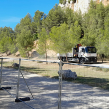](https://www.calanques-parcnational.fr/fr/actualites/chantier-du-reservoir-deau-de-cassis-acces-au-secteur-port-miou-perturbe-0) * [Print](https://www.calanques-parcnational.fr/fr/node/17483/printable/print)